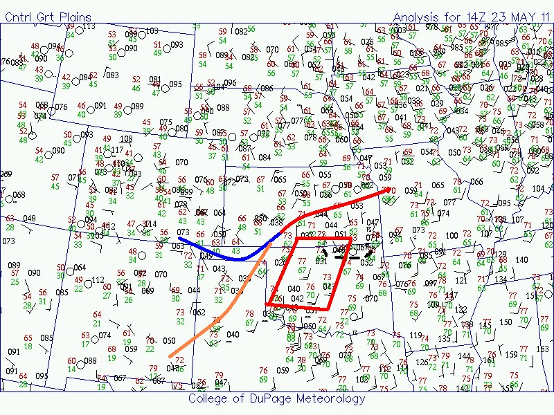
A frontal boundary is orientated NE-SW through the Plains, with a dry-line extending south-westwards from a surface low across SW KS/OK Panhandle area. Very moist air is to the south and east of these features. Overnight storms in NE Oklahoma have left an outflow boundary in the area. Diurnal heating will lead to a very unstable airmass by afternoon, and a number of thunderstorms are expected to develop. Shear is expected to be sufficient for supercells as a shortwave moves through the area this afternoon.
Low-level flow is not especially high, and surface winds are slightly veered at the moment. However, the approaching upper system may allow for some pressure falls to the west, backing the flow slightly.
The target today would appear to be quite large - I think N or NW Oklahoma, as the surface flow could remain backed a bit more with the outflow boundary in place. We're still in Blackwell at the moment, and may well book another night here as tomorrow's outlook suggests this area and perhaps areas east. Indeed, a glance through the various forecast ingredients tomorrow paint a potentially dangerous situation.
No comments:
Post a Comment