Hello.
Not much to report today. We drove from Dodge City to Hutchinson, Kansas, at had lunch there. We were playing a marginal risk of severe storms in eastern Kansas and into Missouri. However, we didn't really want to go too far east for such a marginal risk so we waited at the western edge.
After lunch we drove east to Newton, and waited there for a while. A few showers and storms started to form about 35 miles east so we decided to start heading towards them. We had to drove south on I-135 first. About 10 minutes into this journey, having eyeballed the showers and storms to the east I decided that I couldn't be bothered with this journey! Helen was in agreement so we turned around and headed north towards Salina. A mesoscale discussion was promptly issued by the SPC for the area to the east! However, we'd made our choice so we headed to Salina, and that's where we are for the night.
I have slightly higher hopes for tomorrow's storm chances - some backed surface flow and a boundary should be present across portions of north-central Kansas, and although upper flow is weak, the shear will be close to be reasonable for organised storms and perhaps supercells.
One thing is that this evening is the first evening of the trip where it's actually felt warm - it's still 25C outside just now at 10pm, which is nice!
Wednesday, 31 May 2017
Tuesday, 30 May 2017
May 29th - report
Hello.
We knew that the risk of severe storms was pretty much zero today, so the goal was basically to find a thunderstorm and just enjoy the experience out on the wide open plains.
We decided to head to the NW Oklahoma Panhandle, choosing Boise City to stop for lunch, having left Amarillo earlier in the day.
Whilst having lunch, thunderstorms were developing over the mountains of NE New Mexico, and we expected these to drift slowly eastwards. After lunch we continued west and then north, pausing to view the distant thunderheads en route.
We arrived at Black Mesa, the highest point in Oklahoma, and parked up in the small car park there. By now, the thunderstorms were rather closer, and we started to observe lightning in the distance. Over a period of around an hour or so, we let these storms slowly approach - all around us was quietness, punctuated by the sound of Western Meadowlarks, and crickets. And thunder. The sonorous roll of thunder reverbated around the mesas and hillsides. It was a lovely experience.
As the rain started to arrive, we headed back to Boise City. We decided we would stay in Dodge City, Kansas, and so began the ~160 mile journey. We paused several times en route to view the storms, which slowly followed us. One became severe warned for a time too.
After dinner at Applebee's in Dodge, we saw that lightning was present west of town, so we headed away from the lights to get a few pictures.
All in all it was a very pleasant and relaxing day, taking in the sights and sounds of the High Plains.

Thunderstorm rumbling over a mesa, at Black Mesa, Oklahoma.

Thunderstorm in Kansas.

Same storm over a wheat field in Kansas.

CG lightning to the west of Dodge City.

Cloud-cloud lightning west of Dodge City.
Monday, 29 May 2017
May 28th - report
Hi there.
Not much to report from today. We had a quiet day and drove south of Amarillo to the Palo Duro Canyon State Park, and enjoyed a quiet few hours just soaking the sun and scenery.
We're staying another night in Amarillo. After I had a swim and tub we tried the Big Texan for dinner - but it was packed and there was a 45-50 min wait. We decided we couldn't be bothered with that so went to Red Robin for some very nice burgers.

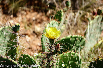
Cactus.

The Lighthouse Rock.

View over the canyon.
Sunday, 28 May 2017
May 28th plan
Hi.
Quiet day today - can't be bothered with heading down to southern Texas so we're staying another night in Amarillo. Just picking up some lunch before we head to the Palo Duro Canyon for the afternoon.
Quiet day today - can't be bothered with heading down to southern Texas so we're staying another night in Amarillo. Just picking up some lunch before we head to the Palo Duro Canyon for the afternoon.
May 27th report - cracking chase day
Hello there.
Well, this morning I was up with the lark and analysing surface charts, model output, etc, and came to the conclusion there were 3 potential targets:


Well, this morning I was up with the lark and analysing surface charts, model output, etc, and came to the conclusion there were 3 potential targets:
- S Central Oklahoma later in the afternoon, ahead of the dry line
- NE Oklahoma/SE Kansas, NE of a surface low, and close to an old outflow boundary
- SE Colorado and adjacent portions of the Oklahoma and Texas Panhandles, where post cold-frontal upslope flow was expected.
It was very hard to make a reasonable choice - part of me was screaming for the higher tornado potential of the Oklahoma targets, but another part was thinking about the wide open High Plains, and the potential for spectacular structure. In the end we tried several methods, e.g. picking out of a 'hat', asking people on Facebook - all of these came up with S Central Oklahoma! As we left the hotel room I reached into the bin to pick out a bit of paper again for a final clue: SE Colorado, it said.
By that stage, in essence, it was too late to have a realistic chance of making it to S Cent Oklahoma. I wasn't so keen on the way the drier air was quickly mixing in from the west, and also, the 'shape' of the dry line and its orientation to the upper flow just bugged me a bit. However, as we'd got burned a bit yesterday in SE Colorado, it was with some trepidation, and something of a headache, that we headed SW and then W to Springfield, Colorado, for lunch.
Storms started to form along the Raton Ridge to our SW, and so we decided to wander down to Boise City, Oklahoma. We then headed west from town and then a little south, and then west again, to take up a vantage point some 30 miles ahead of the storm. We watched it slowly approach and evolve, with some great structure, and CG lightning.
To cut a long story short we then kept ahead of the cell as we dog-legged south and east, seeing even better structure to this cell, before it basically caught up with us a Stratford, Texas.
As we headed SE from town, we drove pretty much under the mesocyclone, and the storm decided that this was enough, and dropped some golfball to hen egg sized hail, perhaps a bit larger. This wasn't such good news!
We then headed to Amarillo for the night, and ate at Applebee's.
Cracking day, somewhat literally!

The supercell hoves into view west of Boise City, Oklahoma.

Same, but looking eastwards, at some spectacular anvil mammatus.

A bit later, north of Felt, Oklahoma.

Same.

Somewhere to the west of Stratford, Texas.
Saturday, 27 May 2017
Springfield, CO, for lunch
Hello.
We've opted for the SE Colorado area - partly due to closer proximity, partly due to the terrain, and partly due to some uncertainty as to how the higher risk further east and south-east will play out. I'm pretty sure some decent stuff will fire down that way - but we're hoping for some nice structure out in the middle of nowhere!
We've opted for the SE Colorado area - partly due to closer proximity, partly due to the terrain, and partly due to some uncertainty as to how the higher risk further east and south-east will play out. I'm pretty sure some decent stuff will fire down that way - but we're hoping for some nice structure out in the middle of nowhere!
May 27th thoughts
Hello.
A fairly complex picture this morning with a fairly high risk of severe weather for portions of the region, mainly eastern Kansas/Oklahoma and points east, and largely from a wind/hail producing line of storms. Some tornadoes possible too. More discrete development is possible in portions of south-central Oklahoma, as well as across the western Oklahoma Panhandle, the latter in a post-frontal upslope flow. This may be picturesque - but we'll probably head towards central Oklahoma and see how things evolve.
A fairly complex picture this morning with a fairly high risk of severe weather for portions of the region, mainly eastern Kansas/Oklahoma and points east, and largely from a wind/hail producing line of storms. Some tornadoes possible too. More discrete development is possible in portions of south-central Oklahoma, as well as across the western Oklahoma Panhandle, the latter in a post-frontal upslope flow. This may be picturesque - but we'll probably head towards central Oklahoma and see how things evolve.
May 26th report - sunshine
Hi. We decided to try the southern target area today - models hinted at storms developing in the classic area north-east of the Raton Mesa/Ridge, across SE Colorado. In the end, a couple of very weak storms did develop, but couldn't quite sustain themselves. Meanwhile, an impressive supercell affected areas similar to where we were yesterday. That's the way the cookie crumbles sometimes!
We did meet up with fellow UK chasers Dan, Matt, Kerry, Adam, and Ellie, which was cool. We also had dinner with Pete and Dave once again, with plenty of laughs. So, although there was tough luck with the storm chasing, we had an enjoyable day none-the-less.
Tomorrow - well, we'll decide in the morning - but there is quite an expansive risk area to our east and south-east, and it could be a very messy day storm-wise.
Friday, 26 May 2017
May 26th - luncheon
Hello.
We've paused for lunch in Ulysses, Kansas, after our overnight stay in Garden City. We're targeting SW Kansas/SE Colorado for a risk of severe storms today.
We've paused for lunch in Ulysses, Kansas, after our overnight stay in Garden City. We're targeting SW Kansas/SE Colorado for a risk of severe storms today.
May 25th - report
Hello.
We started the day in Limon, Colorado, with the idea that areas east or north-east of there would be interesting from a thunderstorm perspective, as moisture had spread in from the north-east behind a weak cold front. Upslope flow, surface heating, and modest upper support were all expected to combine to allow thunderstorms to develop, and vertical shear should help organise these.
We drove to Burlington and met up with UK chasers Tony Gilbert and Dan. We chatted to them for a while as storms developed to the north-west. After a while we headed off just north of town and watched a weak area of thunderstorms to the west gradually become more organised. After a while Pete Scott and Dave Ewoldt appeared and we chatted to them for a while, watching the now strong thunderstorm to our west, which put down some cool CG lightning bolts. Those guys headed off as the rain began to arrive, and we did too, very shortly after.
We headed east on I-70 and found a rest area atop a hill - we stopped there and looked back and were greeted with a great view of the now-supercell storm to our west. Cammie and Tim, UK chaser friends of ours, then turned up so we chatted to them for a while watching the storm move slowly towards us.
As the rain was about to arrive we continued east to Goodland and then dropped south. We wanted to try to stay ahead of the storm but there are precious few roads in the area, and as we then headed ENE towards Oakley, the storm was in a position to cross our path before we could nip through. With 80mph winds and baseball sized hail we decided not to punch through! I measured a 43mph gust at arm-height, which is pretty decent!
In the end we got to Oakley and took stock at a travel plaza. We decided to head to Garden City for the night. Pete and Dave were also in town so we've just had dinner with them at Applebee's, which was a lovely way to round off a very nice chase day.

Pete and Dave and storm clouds

Looking west towards a developing supercell, north of Burlington, CO.

Supercell from a rest area along I-70, just over the border in far NW KS.

Sunset somewhere south of Oakley, in the middle of nowhere, KS.

Jellyfish clouds north of Garden City, KS
Thursday, 25 May 2017
May 25th so far
We're currently Burlington, Colorado, getting lunch and watching and waiting for possible thunderstorm development in the next several hours. The chance of some severe storms is this but it's a little touch and go at the moment.
Day 3 - Limon
Hello. Not a great to report about today. We drove the ~340 miles from Amarillo to Limon, Colorado, in anticipation of a marginal risk of severe storms up this way tomorrow, and a higher risk for Friday. There was barely a cloud in the sky the whole way, with temperatures in the mid-20s Celsius - cracking day!
I had a swim and hot tub before we ate dinner at Denny's. The sky was a gorgeous azure aquamarine to the west after sunset.

I had a swim and hot tub before we ate dinner at Denny's. The sky was a gorgeous azure aquamarine to the west after sunset.

Me enjoying a mid-afternoon coffee in Lamar, Colorado, as caught by the GoPro.
Wednesday, 24 May 2017
May 24th plans
Morning. Today we will drive to Limon, Colorado, in advance of a marginal risk of severe storms up that way tomorrow. Friday looks more interesting as more bountiful moisture arrives, but we'll take it day-by-day.
Day 2 - is this the way?
Hello there.
Today was a nice easy start to the trip. We woke reasonably early, just before 8am, after a somewhat fitful night's sleep: 3am thunder, slight timezone issues, claims of snoring, etc.
The plan was to drive to Amarillo, on our way towards Colorado for the chance of storms from Thursday. We packed up and drove to Wal*Mart to pick up supplies for the trip. I got the various bits of tech to work OK in the car, and we headed off.
Our route took us north from Weatherford, and up to Wichita Falls. We then joined 287 towards Amarillo - a classic storm chaser route, passing by towns and cities which have seen countless storms over the years. We've chased several. We stopped off at the Donley County Rest Area, north-west of Memphis, Texas. We recalled being at the southbound rest area last year, and time-lapsing a supercell to the west, before seeing a nocturnal tornado near Turkey, Texas. That was this day last year!
We continued north-westwards, under partly sunny skies, with temperatures around 19-21C - pretty cool for this area at this time of year! Very pleasant, though.
We got to Amarillo and I had a quick swim and hot tub, before we went to dinner at the Red Robin burger joint, meeting Nathan Edwards and enjoying a nice catch up and burgers.

This year's motor, a Dodge Durango, at Wal*Mart, in Weatherford.

Big skies over the Donley County Rest Area, in the SE Texas Panhandle.

A couple of Common Grackles showing off at the rest area.
Tuesday, 23 May 2017
Arrived!
Good evening. Or morning. Or something!
It's currently 9.47pm CDT, or to us, 3.47am! We've been up since around 6.30am yesterday and, although there was a bit of kippage on the plane, we're pretty knackered now.
We've picked up our car - a Dodge Durango GT - very pleasant! Pics tomorrow. We're now in Weatherford, Texas, and are just in from our first burgers of the trip in - guess where - Applebee's!
I don't think it'll be longer before we conk out now - just a few mins to let dinner go down a bit.
We'll head to Wal*Mart in the morning to pick up some supplies - a well-known ritual for us these days! I'll spend the time connecting up the laptop, and, probably, swearing at it. You never know, though - everything may work like a dream this time!
Plans thereafter - we'll decide tomorrow, but more than likely towards Amarillo ready to continue towards either Colorado or western Kansas on Wednesday ready for the chance of a few storms on Thursday. Late week and into the weekend should bring at least some chances for severe storms.
Stepping out into the Texas evening a bit earlier, with anvil cirrus from storms 90 miles to our west overspreading the sky, along with Altocumulus Castellanus beneath it was a somewhat magical experience for me - a goosebump moment as, all at once, it quickly dawned on me we were here! Not that it hadn't, but you know what I mean!
Monday, 22 May 2017
Just about time!
Morning! A few last moment things to do and items to pack before we head off. Although there is the chance of storms in Dallas later the first couple of days looks quiet before a chance of storms on Thursday in portions of the Central Plains, notably Colorado.
Saturday, 20 May 2017
Preparations!
Hello.
Today, some preparations are taking place ahead of our trip. Things like charging batteries, clearing off memory cards, backing up the laptop, and also deleting quite a few pics from the laptop to free up some space for this year's pics and vids.
Reviewing today's longer range model output shows further hints of what ensembles have depicted - that is, after an unusually deep and digging trough across the southern and south-eastern states early-mid-week, the next trough digging in from the north-west looks to not push so much to the south-east, with the upper flow becoming a rather broad west-southwesterly over the US. This should encourage at least some return flow beneath modest lapse rates, and the chance of some storms through the latter part of the week. This is rather encouraging, given how strong the initial trough is - there were some concerns this would hang around in the east, driving moisture away, and although this is still not out of the question, it looks less likely.
After the weekend, some indications a ridge might try to form over the NW'ern states, ahead of a trough in the Pacific. Models tend to build these too strongly, and ensembles suggest the development of a western trough through the following week. This would suggest storm activity over portions of the Plains, but far too early to tell for sure!
The main thing is, though, to take it day by day and enjoy the experience!
Thursday, 18 May 2017
Starting to gear up!
Hello!
Long time, no post! But we've reached that time of year again where we get ready to head out to the USA for our storm chasing adventure. The anticipation is building!
Today, a nasty outbreak of severe thunderstorms is expected across the Central Plains - strong-violent tornadoes are possible, with portions of southern Kansas and northern Oklahoma at highest risk. This is due, in part, to a strong upper low/trough, which will move slowly east and then north-east from the SW'ern USA over the next few days.
By Monday, this looks like being located somewhere north of the Great Lakes, over Canada. A rather pronounced ridge is likely to be in place over the NW'ern USA, not a sight storm chasers like to see!
By around mid-week, a new trough/low is progged to drop ESE through the northern and central Plains - this should help drive a cold front down to the Gulf states, and perhaps into the Gulf, shutting down any flow of moisture into the Plains for a time (more below!).
Earlier in the week, within a somewhat cyclonic flow regime, SW of the Great Lake low, moisture should be in place over the southern states, and several areas of thunderstorms should be present. A few severe storms may be possible, given reasonable upper level winds, but it may be that it's quite a messy picture.
Back to mid-late week, indications are that, under a rather broad/nebulous westerly flow, without any real focus trough-wise, moisture should start to return northwards through SW and W Texas. This is when some rather large differences in model output creep in. GFS is 'keen' on keeping a broad ridge-trough pattern in place, somewhat detrimental to chasing, but not totally. *If* moisture can move back north through the Plains, then some 'north-west flow' events, including MCS development, are possible.
On the other hand, the trend of ECMWF, overall a better model, is to tend to flatten the pattern (nice rhyme!) towards the end of next week, and instead of bringing another trough SE'wards, keeps it towards the Pacific NW and, thus, a broad westerly or SW'erly flow over the Plains. This would encourage moisture return, and whilst not guaranteeing thunderstorms, certainly puts one of the key ingredients in place, should subtle perturbations move through.
It should be noted that the ensembles of both models are somewhat split between these two scenarios. Trying to be objective, it does appear that the ECMWF trend has some support from how the ensembles have trended too - a few more of today's runs support this than yesterday. Let's see!
Beyond that it's really up in the air, so to speak (indeed, even later next week is far from certain!). However, quite a few suggestions that by the turn of the month, if not a bit before, western troughing should be more prevalent, which could signal a more robust uptick in potential.
As always, though, the main chase philosophy is to take it day by day, appreciate being out on the wild, wide open Plains, enjoy the hospitality, and just soak it all up. And take pictures. And videos. And eat burgers!
Subscribe to:
Posts (Atom)